Last updated: 29/06/26
France Pushes BVLOS Boundaries on Live Motorway
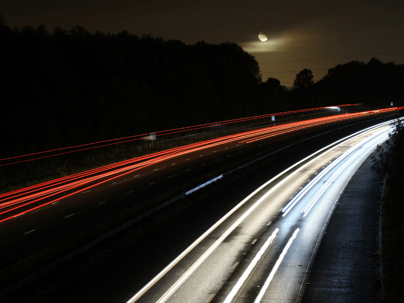
Unmanned Airspace reports that a pioneering French trial has successfully demonstrated Beyond Visual Line of Sight (BVLOS) drone operations over a live motorway at night and in the day, a national first. The project brings Delair, Egis and Alicorne together to test long-range drone monitoring under real traffic conditions, with missions simulating real-world safety and risk detection scenarios.
The team completed their two-hour flights in both daylight and darkness, each covering up to 120km, and streamed data in real time to the motorway control centre. The milestone highlights the growing potential for BVLOS drones to enhance infrastructure monitoring, incident detection and operational decision-making, especially in complex night-time environments where traditional surveillance tools are limited.
- Read the full article at Unmanned Airspace: French project completes day and night BVLOS drone trial over motorway

Drones Unlock Easter Island’s Hidden Past
Drones, GIS and advanced remote sensing are helping to rewrite the long-standing narrative of Easter Island’s iconic moai statues. By capturing thousands of high-resolution aerial images and building detailed 3D models, researchers have created a digital twin of the island, enabling them to study fragile archaeological sites without excavation and uncover new evidence about how the statues were made and the society that built them.
The findings challenge the long-held “collapse” theory, instead revealing a more complex and sustainable society made up of smaller, decentralised groups. From identifying multiple carving workshops to detecting hidden freshwater sources, drone technology is providing fresh insight into how the Rapa Nui people thrived, demonstrating how modern aerial tools can transform our understanding of ancient worlds.
- Read the full article at Commercial UAV News: An Island of Ingenuity: Drone Imagery and GIS Help Recast the Story of Easter Island

Kenya’s Next Chapter in Drone Delivery
A new partnership between ThatcherX and The Good Drone Company is set to accelerate autonomous cargo drone operations across Kenya, building on years of collaboration in medical supply delivery. With ThatcherX holding national regulatory approval and local expertise, the agreement formalises a move towards scaled, BVLOS-enabled logistics, positioning Kenya as a key launchpad for advanced drone delivery services in East Africa.
By integrating hybrid VTOL fixed-wing aircraft capable of longer-range, higher-payload missions, the initiative aims to expand beyond healthcare into broader commercial and humanitarian logistics. The partnership highlights growing confidence in drone delivery networks to overcome infrastructure challenges, offering faster, more reliable transport across remote and underserved regions.
- Read the full article at Unmanned Airspace: ThatcherX and The Good Drone Company team up for drone delivery across Kenya

AI and Drones Transform Conservation with Smart Forests
Drones and AI are reshaping how conservationists monitor and restore forests in Romania’s Făgăraș Mountains. By capturing hundreds of high-resolution aerial images and converting them into detailed georeferenced maps, teams can track vegetation, assess reforestation progress and monitor ecosystem change across vast, hard-to-reach landscapes.
AI-powered analysis takes the data being captured by drones further, automatically identifying plant cover, measuring seedling survival and evaluating natural regeneration. The result is faster, more accurate insight that enables data-driven decisions, helping conservationists protect biodiversity and strengthen long-term restoration efforts in one of Europe’s most ecologically important regions.
- Read the full article at Endangered Landscapes & Programme: Drones and artificial intelligence support forest monitoring in the Făgăraș Mountains

Network Rail Embraces Remote Drone Operations
Network Rail is taking a major step forward in infrastructure management by rolling out remotely operated BVLOS drones across parts of its network. Following approval from the UK Civil Aviation Authority, the drones will be deployed in locations including Gloucester and Romford. They will be operated entirely from a central command centre, enabling real-time aerial monitoring without the need for on-site personnel.
The initiative is designed to improve situational awareness, speed up incident response and enhance railway security, with drones providing live data to support faster, more informed decision-making. By reducing the need for trackside inspections and enabling rapid assessment of faults or disruptions, the technology promises safer operations, minimised delays and a more resilient rail network for passengers and freight alike.
- Read the full article at Network Rail: Network Rail rolls out remotely operated drones to monitor and protect the railway

Falcon-Inspired Drone Protects Strawberry Crops
A falcon-mimicking drone is offering a high-tech, wildlife-friendly solution to one of agriculture’s most persistent problems, crop damage from birds. Trialled on strawberry farms in Queensland, the flapping-wing “RoBird” replicates the size, shape and flight behaviour of a peregrine falcon, triggering a natural predator response that drives away pests such as rainbow lorikeets without harming them.
The technology could prove transformative for growers facing significant financial losses, with bird damage costing Australian agriculture hundreds of millions annually. Early trials have shown promising results, with significant reductions in crop damage, highlighting how biomimicry and drone innovation can deliver scalable, non-lethal protection while supporting biodiversity and farm productivity.
- Read the full article at ABC News: Falcon-like flapping drone drives birds away from strawberry crops in Qld trial

Seeding Change as Drones Replant the Peak District’s Hidden Ravines
Drones are taking on one of the UK’s most challenging conservation tasks, helping restore fragile ravine woodlands in the Peak District devastated by ash dieback disease. As part of the “LIFE in the Ravines” project led by Natural England, specially designed drones are being used to disperse native tree seeds across steep, hard-to-reach slopes at sites such as Dovedale and Lathkill Dale, where traditional planting would be unsafe or impractical.
By mimicking natural seed dispersal, the technology offers a safer, faster and more scalable approach to reforestation in complex terrain. The trial marks a significant step forward for drone-enabled conservation, demonstrating how aerial innovation can unlock new possibilities for restoring biodiversity and building more resilient landscapes in even the most inaccessible environments.
- Read the full article at GOV.UK: Drones take flight to help restore Peak District ravine woodlands

Police Drones Tackle Jet Ski Misuse
Police in Devon are turning to drone technology to crack down on unsafe and anti-social jet ski use along the Teignmouth waterfront. With a bird’s-eye view of the estuary, officers can monitor activity in real time, helping them identify dangerous behaviour more quickly and gather evidence without being physically on the water.
The initiative comes as warmer weather draws more visitors and increases the risk of incidents, including a recent serious injury involving a jet ski rider. By combining drones with tools such as CCTV and ANPR, authorities aim to deter reckless behaviour while promoting safer, more responsible enjoyment of coastal waters throughout the busy summer season.
- Read the full article at the BBC: Police use drones to target rogue jet ski users
Drone Insurance Specialists
At Coverdrone, we specialise exclusively in drone insurance. Our only focus is to support drone operators with their insurance needs (and you can see what our customers think of how well we do that in our reviews). If you want to cover your drone, click the button below to get a quote in minutes.