Drones in agriculture are now used for crop monitoring, land surveying, livestock checks, infrastructure inspections and specialist spraying operations. For farmers, agricultural contractors and commercial drone operators, they provide a practical way to gather information across large or difficult areas. These operations can also involve valuable aircraft, specialist sensors and third-party risks, making suitable and compliant insurance a crucial part of the operator’s toolkit.
Our guide to drones in agriculture looks at 10 of the most useful ways agricultural drones are currently being used to improve farming operations around the world.
1. Monitoring crops from above
Crop monitoring remains one of the clearest applications for agricultural drones.
A high-resolution camera can give farmers and agronomists a view of an entire field that would be difficult or prohibitively expensive to achieve from the ground. Differences in crop development, water stress, weed growth etc may become easier to identify earlier when farmers can view land in context from above.
The value increases when flights are repeated. Over and above simply providing a high-quality aerial image, the drone gathers useful information – one survey gives a snapshot, while regular flights throughout the growing season create a reliable record of how a crop is developing and where closer investigation may be worthwhile.
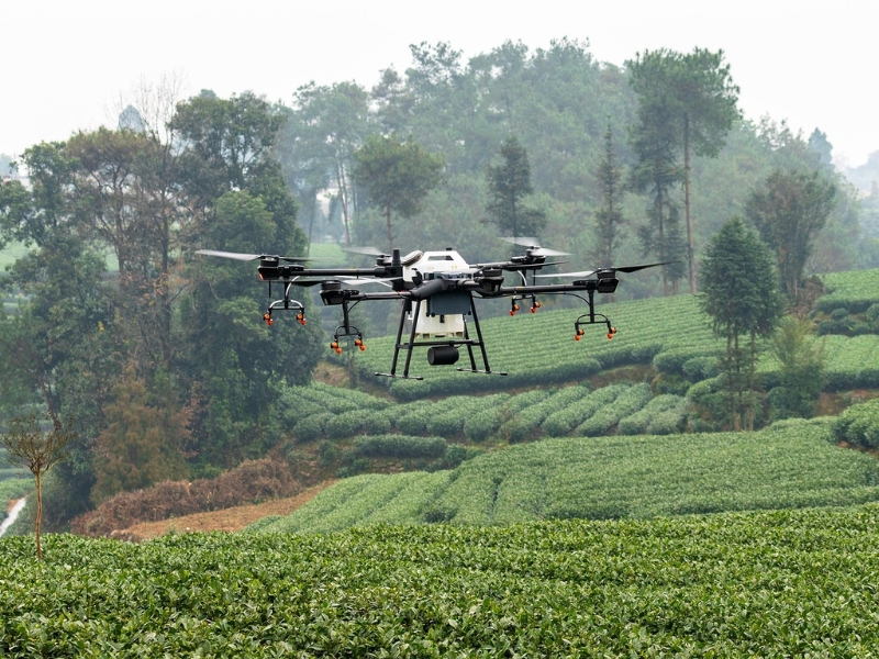
2. Spraying and spreading agricultural materials
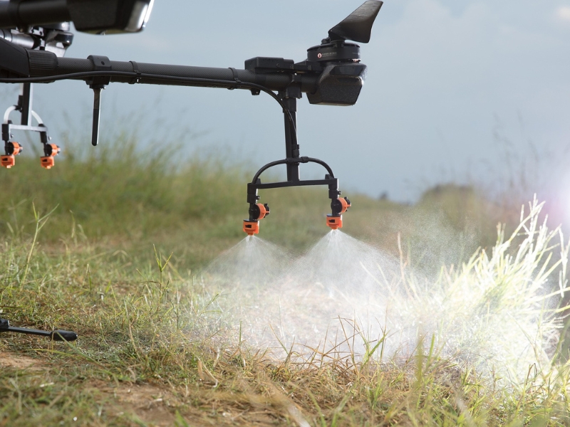
Purpose-built aircraft can carry tanks, pumps, nozzles or spreading systems and distribute liquids, granules or seed across a defined area. In some markets, these systems are already used where terrain or ground conditions make conventional machinery harder to deploy.
A useful example comes from New Zealand, where Felton Road Wines has introduced an electric agricultural spray drone across its vineyard. An Energy Efficiency and Conservation Authority case study describes its use on steep terrain as an alternative to tractor-based spraying, with benefits including reduced soil compaction and lower operator exposure during applications.
These aircraft can be considerably larger and more complex than standard camera drones. The payload can also create additional risks, particularly where chemicals or other treatments are being applied near neighbouring land, crops or property.
One specific exposure is unintended chemical drift. Material released during an application could move beyond the intended area and affect third parties.
Coverdrone offers Chemical Drift Liability as a selectable cover option for relevant commercial drone operations – it is designed to meet the real-world needs of operators. It is also important to note that many insurance providers will have pollution exclusions in their policy, but under Coverdrone’s Public Liability Insurance, you are covered for pollution incidents if they occur as part of the drone’s operation.
If spraying forms part of your operation, you can get a drone insurance quote and select the cover options relevant to your work.
The rules governing aerial spraying and spreading vary significantly between countries. Operators should establish what is permitted where the work will take place before undertaking an application.
3. Supporting precision agriculture
Precision agriculture focuses on understanding variations within farmland and using that information to make better-informed decisions.
Precision agriculture drones may carry multispectral or other specialist sensors capable of recording information beyond conventional photography. The resulting data can be processed into vegetation indices such as NDVI (Normalised Difference Vegetation Index), which can help highlight differences in plant vigour across a field.
A USDA Agricultural Research Service review of drones and remote sensing in agriculture highlights applications including crop water status, nutrition, yield, soil mapping and the detection of weeds, insects and pathogens.
For example, a drone may show that two areas of a field are behaving differently, but understanding why still requires agricultural expertise, so drones have become increasingly important tools in enhancing farming operations. For operators providing precision agriculture services, explaining the limitations of the data is just as important as explaining its capabilities.
4. Mapping and surveying agricultural land
Agricultural drone mapping has become a significant area of commercial drone work.
By capturing overlapping images during a planned flight, operators can produce orthomosaic maps, three-dimensional models and elevation information. More specialist surveys may use LiDAR where additional terrain or structural detail is required.
These outputs can support tasks such as recording field boundaries, assessing terrain, planning drainage or documenting changes across a site.
Accuracy matters. A quick aerial overview and a detailed survey dataset serve different purposes, so the aircraft, sensor and processing workflow need to reflect the intended use.
Specialist cameras, positioning systems and LiDAR payloads can also represent a significant proportion of the overall equipment value. Operators should consider the aircraft and payload together when reviewing their insurance arrangements.
If you use drones commercially for agricultural mapping or surveying, you can get a quote for commercial drone insurance based on the aircraft and equipment you operate.
5. Inspecting irrigation and drainage
Water problems are often easier to understand when the whole area is visible.
Standing water, damaged drainage or irrigation issues may be difficult to appreciate from a single position on the ground, so a drone gives farmers and contractors a broader view of how water is moving across the land.
Following heavy rainfall, for example, an aerial survey may show which areas are retaining water and whether the problem appears isolated or widespread. Thermal and other specialist sensors may add further capability depending on the crop and conditions.
The EU-funded SmartVitiNet precision viticulture project has combined drones, advanced sensors and decision-support tools in vineyards across several European countries, including work focused on identifying water stress before visible symptoms appear.
In many cases, the drone acts as a first-stage inspection tool, helping people on the ground decide where to focus next.
6. Monitoring livestock
Drones and farming extend well beyond crops and crop management
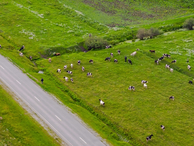
On large farms or across difficult terrain, locating and checking livestock can take a considerable amount of time and effort. A drone minimises this significantly, providing a quick overview of a wider area and helped identify where animals are without travelling across every field or mobilising equipment.
Thermal cameras may provide additional capability in suitable conditions, particularly where animals are difficult to identify using conventional imagery alone.
An Agriculture Victoria trial involving nine sheep producers tested drones for monitoring sheep welfare alongside jobs such as checking water troughs, pasture, fencing and irrigation channels. The project also highlighted practical limitations, including battery endurance and the need to avoid disturbing livestock.
Aerial observation does not, of course, replace physical welfare checks, but it can help farmers and contractors understand where their attention is needed, helping them to prioritise accordingly.
7. Inspecting farm buildings and infrastructure
Agricultural sites often include substantial infrastructure and equipment spread across a wide area.
Barns, silos, roofs, solar panels, fencing, drainage systems and access tracks all require inspection and maintenance. Drones allow operators to examine elevated or difficult areas without immediately requiring someone to work in a potentially high risk scenario (such as height or difficult terrain).
Following severe weather, for example, a drone can provide a close visual record of roof or structural damage and help establish whether further investigation is needed.
Flying close to buildings also changes the risk. Manoeuvring space can be reduced and the consequences of a collision may be greater, making careful planning and appropriate insurance particularly relevant.
For commercial drone businesses, there can also be a wider opportunity. A client who initially requires crop imagery may have several other inspection needs across the same site.
Using drones professionally in agriculture? Coverdrone provides specialist commercial drone insurance for professional operators.
8. Assessing storm and flood damage
Severe weather can affect large areas of farmland quickly, while the same conditions can make physical access difficult.
A drone can help establish the wider picture quickly, before people and resources are directed to individual areas. Aerial imagery may record visible crop damage, flooding, erosion, fallen trees or damage to buildings and infrastructure.
Repeat surveys can then show how conditions change, whether that means floodwater receding, access being restored or repairs being completed.
9. Supporting environmental and conservation work
Agricultural land is increasingly managed with environmental objectives alongside its productive use.
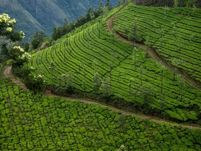
Drones can support surveys of hedgerows, woodland, watercourses, habitats and other rural features. Because the same area can be revisited regularly, drones are particularly useful where change needs to be tracked over time.
Aerial imagery might show how vegetation is developing, where erosion has occurred or how a watercourse has changed after heavy rain. Mapping data can also contribute to wider land-management and conservation projects.
For commercial operators, this work often sits between agriculture, surveying and environmental consultancy. The aircraft may be familiar, but the required output can be very different, making good project scoping essential.
10. Surveying difficult or inaccessible areas
Some agricultural sites include areas that are slow, difficult or potentially hazardous to reach.
Steep ground, wetlands, woodland, riverbanks and flooded fields can all make conventional inspection harder.
A drone allows operators to assess an area before anyone enters it. That can help establish the scale of a problem, determine whether physical access is necessary and identify what equipment may be required.
The work might involve conventional imagery or a more detailed survey using thermal, multispectral or other specialist sensors.
This is a good example of why professional agricultural drone work requires more than piloting skill. The operator also needs to understand what the inspection is intended to achieve and where the limits of an aerial assessment begin.
What are the benefits of drones in agriculture?
The strongest agricultural drone applications solve practical problems.
They may allow somebody to inspect a large area more quickly, reach a difficult location or collect information that would be hard to obtain from the ground. Repeat flights also make it easier to compare conditions over time.
For commercial drone operators, one agricultural client may have several requirements, from crop surveys and mapping to building inspections and environmental work.
That also means the risk can vary substantially between jobs. A crop-imaging flight is very different from carrying an expensive LiDAR sensor or operating a larger spraying drone.
The aircraft, payload, environment and purpose of the flight all need to be considered together, particularly from an insurance perspective.
Planning an agricultural drone operation
The right equipment depends on the job.
A visual crop inspection may require a conventional camera, while precision agriculture may involve multispectral sensors. Detailed surveying may call for high-accuracy positioning or LiDAR, and spraying operations require purpose-built aircraft.
The environment matters too. Farmland may look open from above, yet it can contain power lines, trees, buildings, machinery, livestock and public access routes.
Commercial operators should also understand the rules that apply where they are flying, as aviation and agricultural requirements vary between jurisdictions.
Agricultural Drone Insurance: protecting the operation as well as the aircraft
Agricultural drone insurance should reflect the work being undertaken, not only the aircraft being flown.
A crop-imaging flight, LiDAR survey and spraying operation may all sit within the same sector but involve very different equipment and exposures.
Specialist sensors can carry substantial value, while operators may also work around buildings, machinery, livestock and third-party property.
Spraying can introduce another exposure. Where chemicals or treatments are applied, unintended drift could affect neighbouring crops, land or property. Coverdrone offers Chemical Drift Liability as a selectable cover option for relevant commercial drone operations.
Coverdrone has specialised in drone insurance since 2007 and provides commercial drone insurance for professional operators across a wide range of industries and applications.
If you already operate drones in agriculture, or are adding agricultural work to your services, you can get a commercial drone insurance quote online.
Our own claims experience also provides useful context. Coverdrone’s analysis of the top reasons for drone insurance claims in 2025 found pilot error was the most common claim category.
Agricultural sites often include trees, power lines, buildings, machinery and uneven take-off areas, while some operations also involve expensive sensors or specialist payloads.
Careful planning and suitable equipment remain central to managing those risks, with insurance providing financial protection when things go wrong.
Frequently Asked Questions about Drones in Agriculture
How are drones used in agriculture?
Drones are used for crop monitoring, precision farming, mapping, livestock checks, building inspections, environmental monitoring and damage assessment. Specialist aircraft may also carry spraying or spreading equipment where permitted.
What is a precision agriculture drone?
A precision agriculture drone collects detailed information about crops or agricultural land, often using conventional, thermal or multispectral cameras.
Can drones monitor livestock?
Yes. Drones can help locate and observe livestock across large or difficult areas, while thermal sensors may add further capability in suitable conditions.
Can agricultural drones spray crops?
Purpose-built agricultural drones can carry spraying or spreading systems. What is permitted varies between jurisdictions, so local aviation, agricultural and environmental requirements need to be checked.
What should agricultural drone operators consider when arranging insurance?
Operators should consider the aircraft and payload, specialist equipment, third-party liability and the type of work being undertaken. For spraying operations, Chemical Drift Liability may also be relevant.
The growing role of drones in farming and agriculture
Agricultural drones now support serious commercial work across crop management, livestock, surveying, infrastructure and land management.
For drone operators, agriculture offers opportunities ranging from visual inspections to precision agriculture, mapping and specialist application work. For farmers and agricultural businesses, drones provide another way to understand what is happening across land, crops and assets.
The best results start with a clearly defined job. The aircraft, sensor, flight plan and insurance arrangements can then be considered around the work being undertaken.
If you use drones for farming, agricultural surveying, land management, spraying or other commercial work, explore our commercial drone insurance or get a quote for your operation.